Sustainable energy and the protection of our natural resources are predominant topics of today’s society. As natural resources on Earth are limited and at the same time worldwide demand for energy, water and food is rising, Earth observation (EO) data holds huge potential to tackle these issues by providing valuable information.
What do hydroelectric power plants, spatial planning authorities, health personnel and biodiversity researches have in common all around the globe? The demand for accurate, timely and continuous information on a large scale over long periods of time, in brief EO data. This spaceborne data not only helps to face the most pressuring contemporary challenges in the areas of sustainable living, energy, environment and health, it also allows for detecting future trends and thereby benefiting our society.
How EO Data Supports Various Sectors
Copernicus data’s fields of application are just as diverse as its huge amount of data from space. Through monitoring the land, the atmosphere and ocean environments, EO data provides precise and up-to-date information about our planet. These sheer amounts of data hold big potential for the protection of the environment as well as the management of natural resources and energy. The power of this data is unleashed as soon as it is used for related fields including environment pollution, forestry management as well as air and water quality.
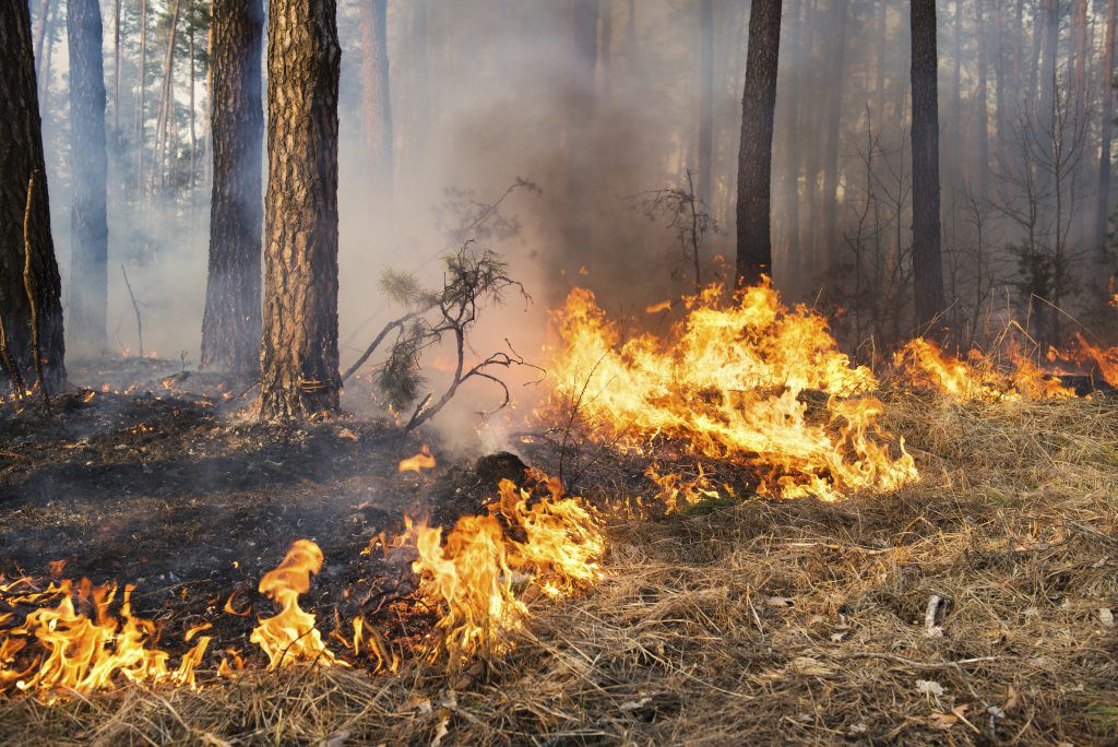
DeforestAction: Crowdsourced Rainforest Monitoring Platform
An excellent example is the Ideas Challenge winner and overall winner 2011, DeforestAction, as it combines the forces of Earth observation with social media, human computation and collaborative intelligence. Through the use and integration of near real-time satellite data, the monitoring platform is able to aid capture illegal deforestation. The platform can hold tremendous amounts of data including high resolution imagery as well as video footage from various data sources. Thereby, it provides a new approach to education by involving huge numbers of students as users directly in the work progress with direct access to actual data. The generated intelligence and findings are shared by using the collaboration environment of social media. The monitoring platform has expanded its activities to South America, where it collaborates with Greenpeace Argentina.
Tackling the Sustainable Energy Challenge with Satellite Data
Comparing the altitude of a satellite and that of a plane on a surveillance mission, the satellite always has the wider range of vision and can provide the images constantly over long periods of time. This offers manifold opportunities to several of fields of application which demand near real-time data in high resolution from up above. The observation of natural forces and the Earth’s surface from space is not only spectacular but it also serves as a high-quality big data provider. The assessment for example of solar radiation is enabled by the mapping and monitoring of the clouds in respect to space and time and thereby allows long-term evaluation at high spatial resolutions. Especially nowadays, as the awareness of renewable resources is continuing to increase, offshore wind farms are expanding and demanding accurate information of how the winds change and how they affect the waves, in order to use the energy they bear efficiently.
The DLR Environmental Challenge 2012 winner ThermCERT focuses on the demand of improved energy efficiency of houses and buildings, by using infrared Sentinel satellite images and merging them with available ground-based data. The thermal efficiency is a key challenge that has to be tackled in order to reduce the carbon footprint. Especially high populated and frequented cities and regions have to be analysed in order to support smart and sustainable developments in the building sector. The EO data ThermCERT uses for its thermal and carbon efficiency reporting tool helps to target, communicate and promote thermal efficiency investments on a global scale.
Monitoring Water Resources from Space
EO data is also very convenient for issues regarding monitoring of water quality, by providing high resolution pictures collected in space combined with other data sources. Next to monitoring, the mapping of great waters is another benefit resulting from the use of space-generated data. The world’s first complete mapping of Australia’s Great Barrier Reef was accomplished by EOMAP, multiple Copernicus Masters winner, with its operational satellite-derived bathymetry service. This demanded data is provided by the European Copernicus programme.
Fresh water is a natural resource many parts of the Earth already lack today. At the same time the pollution of fresh water lakes with cyanobacteria is a serious global threat. As this tendency is increasing, the Ideas Challenge 2014 winner CyanoLakes provides a solution that functions as a public warning system for cyanobacteria relying on satellite-based data. Its service uses accurate and up-to-date Copernicus high resolution images, in order to supply government authorities and other public organisations with information regarding destructive cyanobacteria blooms and respective nutrient enrichment in fresh water lakes. This service can prevent health impairments for humans and animals and therefore provides an added value for the public.
Have you come up with an idea for using EO data to solve current environmental, energy or health issues? Then take a close look at this year’s DLR and Catapult Challenge.
The DLR Environment, Energy and Health Challenge
The German Aerospace Center (DLR) is seeking new applications in Earth observation dealing with climate change and the mapping of the environment. Do you have an idea that relates to the application fields of sustainable environment and energy management? Or can you think of a solution tackling issues in regards to broad field of human health? Then do not miss the opportunity and make your idea happen. It is mandatory that the proposals are based on existing or imminent Earth observation data, preferably originating from Copernicus. Proposed ideas can include any type of additional geo-information, including crowdsourced data or in-situ measurements, as to contribute to enhance the quality and application of the data.
Sustainable Living Challenge by the Satellite Applications Catapult
This Challenge from the Satellite Applications Catapult is in search of innovative solutions that tackle the key challenges the growing global population is facing. Do you have a solution that combines EO imagery with other data sources? You believe that quality can be improved by combining different data sources? Then realise your idea and take it off the ground. Submitted ideas that have potential of providing the fields of agriculture, smart cities and resilient infrastructure and natural resource management in commercial ways are especially in favour of the expert jury. Prototypes are not necessary. However participants are required to demonstrate how their idea can be implemented, as well as the involved data sources and point out the market opportunity.
Copernicus Masters
Earth observation and the big data it produces hold huge potential for the creation of innovative products and services. Myriad industries and areas of public interest stand to profit from the advances of the Copernicus programme. On behalf of ESA, AZO and its world-class partners launched the Copernicus Masters in 2011 as part of its mission to foster user uptake of Copernicus Services.